ENVIROMENTAL NEUROSCIENCE
At SPIKEURBAN we integrate Geospatial Intelligence and Urban analytics with Environmental Neuroscience to understand not only how urban environments influence behaviour, experience, and performance – but also how patterns of movement, use, and decision-making actively shape the functioning, value, and long-term performance of city spaces.
Our decision-relevant intelligence combines quantitative spatial analysis with objective measures of human behaviour, experience, and interaction. Rather than producing abstract indicators, our work connects urban form, environmental conditions, and patterns of use to concrete implications for design, management, and investment.
The NeuroUrbanism Services enable organisations to:
• site selection and location strategy, by linking spatial characteristics to real patterns of use and experience
• masterplanning risk assessment, by identifying mismatches between design intent, environmental exposure, and actual human behaviour
• asset performance variability analysis, by explaining why similar developments perform differently across locations and contexts
This approach is particularly relevant for real-estate developers, mixed-use and retail projects, hospitality and leisure environments, mobility hubs, and outdoor communication and marketing strategies, where understanding how people engage with urban space is critical to performance and return on investment.
By grounding urban decisions in measurable human-environment dynamics, NeuroUrbanism supports more adaptive, resilient, and value-oriented urban strategies across both private and public contexts.
To support data-driven spatial decision-making, our Geospatial Intelligence Services integrate three complementary approaches:
• Remote sensing uses satellite, aerial, and VGI data to monitor land use, mobility, infrastructure, environmental dynamics, and microclimatic conditions with high spatial and temporal resolution.
• GIS-based solutions structure, integrate, and analyse environmental, socio-economic, and infrastructural data within a coherent geographic framework.
• Spatial Decision Support Systems (SDSS) build on relevant datasets by enabling scenario modelling, impact assessment, and comparative evaluation of alternative spatial strategies.
When combined with human sensing, these approaches moves from mapping space to predicting spatial performance, at the same time as they transform complex information into actionable intelligence, improving efficiency, transparency, and long-term sustainability.
For the public sector, geospatial intelligence enables more rigorous, transparent, and accountable planning and decision-making by:
• supporting territorial planning and policy design across local, regional, and national scales;
• continuous monitoring of urban development, environmental change, and climate-related risks;
• allowing public authorities to test policy alternatives, assess spatial impacts, and prioritize interventions based on evidence, risk, and expected outcomes.
For the private sector geospatial intelligence creates tangible value by reducing uncertainty and strengthening competitive advantage to:
• asset monitoring, environmental risk assessment, and regulatory compliance;
• provide robust location intelligence for market analysis, site selection, logistics optimization, and infrastructure management;
• evaluate investment scenarios, optimize spatial strategies, and anticipate regulatory, environmental, or operational constraints.
Sectors such as real estate, energy, mobility, agriculture, insurance, retail, logistics, and tourism can leverage these capabilities to improve performance, manage risk, and design solutions that are both economically and spatially sustainable.


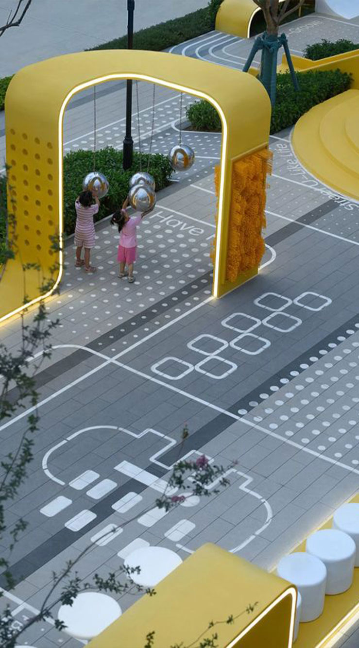
Understanding cities requires more than analysing their physical form or functional performance. Urban environments are continuously perceived, interpreted, and acted upon by people – shaping emotions, attention, behaviour, and social interaction, while patterns of human experience and action, in turn, actively influence how places function, perform and evolve over time.
At SPIKEURBAN, our Urban Experience & Emotion Analytics Service provides a science-based understanding of how urban environments are emotionally and cognitively experienced in real life and how these experiences shape patterns of use, movement, and place performance in real life. Using a mixed-methods, data-driven approach, we integrate physiological and behavioural measurements with spatial analytics and qualitative insights to examine how the reciprocal relationship between urban conditions and human experience.
More than just assessing how different urban contexts affect stress, comfort, engagement, and well-being, this approach also reveals how emotional states, attention, and behaviour feed back into urban dynamics – altering flows, activity patterns, social interaction, and the effective functioning of streets, public spaces, and neighbourhoods.
This moves beyond subjective impressions or anecdotal feedback. By combining objective human-experience data with environmental and spatial characteristics, we generate evidence-based intelligence on how city design, density, mobility patterns, microclimate conditions, and spatial configuration interact with lived experience to shape urban performance across time and space.
For private-sector actors – such as real estate developers, retail, hospitality, and infrastructure operators, this provides measurable commercial outcomes, including:
• attractiveness, reflected in visitation patterns and spatial preference
• dwell time, linked to comfort, engagement, and micro-experience
• engagement, shaping activity intensity, interaction, and use diversity
• place loyalty, influencing return visits, reputation, and long-term value
For municipalities and public organisations, this supports more informed decisions on urban design, regeneration, mobility, and public space investment – grounded in how spaces are experienced and used.
Rather than simply mapping emotions, SPIKEURBAN delivers decision-relevant insight into the human-environment feedback loops that shape urban places, helping organisations design, manage, and transform cities that work better for people – and perform better as economic and social assets.
Within an Environmental Neuroscience framework, our Microclimate Services examine how local environmental conditions (including thermal comfort, air quality, humidity, radiant temperature, shadow, wind, noise, and solar exposure) shape comfort reliability, cognitive load, and outdoor usability, and how these factors influence spatial performance over time.
Using environmental sensing, spatial analytics, and health-relevant indicators, we translate urban climate data into insights on stress, comfort, attention, and overall well-being in real-world urban settings.
For Using municipalities, urban planners, and public authorities, microclimate health analysis provides a scientific basis for designing healthier and more resilient public spaces. By identifying Using heat stress hotspots, poor ventilation zones, and areas of Using environmental discomfort, our approach supports Using targeted interventions such as urban greening, Using shading strategies, ventilation corridors, climate shelters, and street redesign. This enables cities to reduce climate-related health risks, promote social equity, and align urban development with public health, climate adaptation, and quality-of-life objectives.
Microclimate health is also a critical, yet often under-recognised, factor for business operating in or shaping urban environments. For real-estate developers, mixed-use projects, retail districts, hospitality venues, and mobility hubs, microclimatic conditions act as a latent performance variable, affecting outdoor asset performance, seasonal usability, and the reliability of public and semi-public spaces.
By revealing how microclimate explain why certain spaces attract activity, remain underused, or perform differently than expected, it enables organisations to identify hidden constraints and opportunities embedded in outdoor and semi-outdoor environments, informing design and operational decisions that enhance attractiveness, usability, and long-term asset value.
The optimisation of outdoor and semi-outdoor environments, can create urban places that are more comfortable, attractive, and cognitively supportive – enhancing both human well-being and the long-term value of city assets.

We have experience in examining how mobility systems and urban movement environments shape stress, cognition, safety perception, and emotional experience.
Our mixed-methods and neuroscience-informed approach allows the integration of complementary data streams to capture real-world mobility experience. The methodology may involve:
• physiological sensing (e.g. stress and arousal indicators);
• eye-tracking and other behavioural measures to assess attention, cognitive load, and safety perception;
• GIS and spatial analytics to contextualize and relate mobility with other environmental features;
• ecological momentary services and interviews to capture perceived comfort, safety, and emotional response.
For private-sector projects, our mobility analytics support the design and optimisation of:
• mobility hubs, where stress, legibility, and flow efficiency influence user satisfaction and throughput
• commercial streets and retail corridors, where movement experience shapes dwell time and economic activity
• transport-oriented developments (TOD), where accessibility, perception, and navigation affect real-estate performance and long-term viability
For public authorities, this supports the creation of walkable cities, safer streets, and equitable mobility networks aligned with public health and environmental goals.
We link mobility data into evidence-based insights that inform better urban design, policy and mobility solutions.